blah blah blah
Bald Ledge
Length: 1.6 miles out-and-backDifficulty (click for info): Beginner
Elevation Gain: 100 feet (+120 feet on return)
Rating (click for info): 6/10
Elevation: 1133'
Prominence: 26'
Driving Directions:
Trailhead and parking area are on Sky Pond Road in New Hampton, NH. From Rt. 132 in the center of Ashland, 0.2 miles southeast of the junction with Rt. 3, drive east on Winona Road. In 0.7 miles, turn right onto Dana Hill Road. Then, in another 0.7 miles, turn left onto Lower Oxbow Road, which becomes dirt. In 1.2 miles, take a left onto the somewhat steep Sky Pond Road. Drive 0.8 miles to the end of the road, where you will encounter a three-way junction. Left is a private driveway, straight ahead Sky Pond Road continues as a class 6 road, which is the start of the trail, and right leads down to a boat launch, where the best parking is available. Click here for a Google map.
About the Hike:
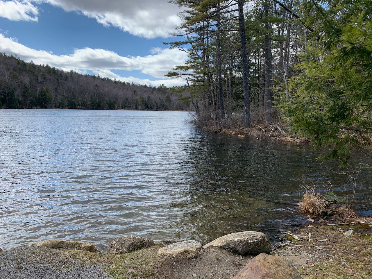
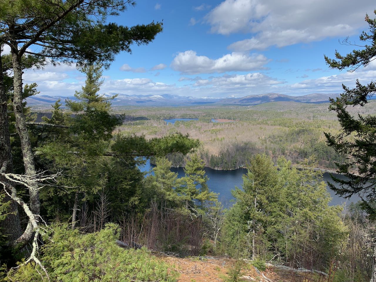
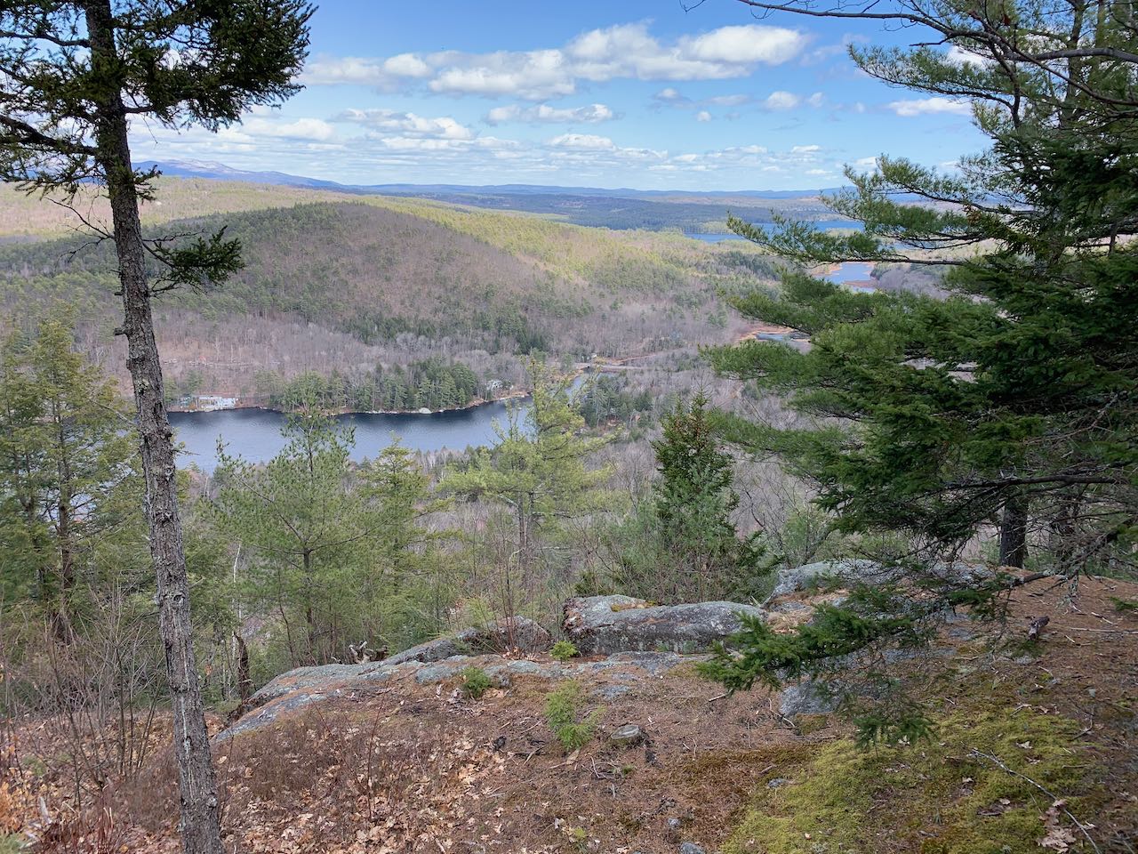
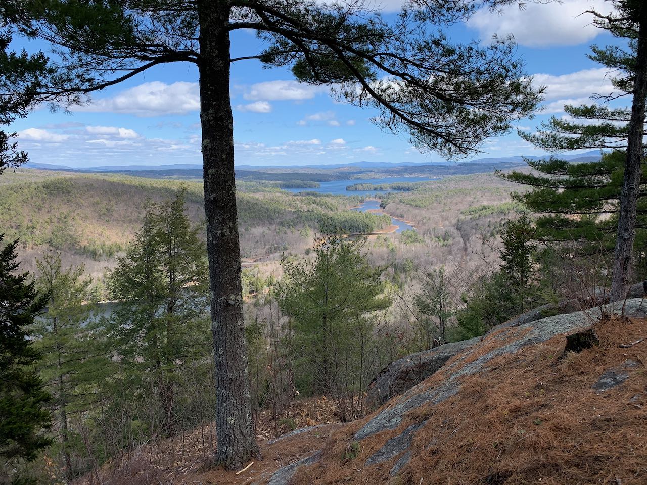
Hidden over in a rural corner of the lakes region just outside bustling Ashland and under a mile away from the geographic center of New Hampshire, Bald Ledge watches over some of the smaller waterbodies further away from Winnipesaukee and Squam. Situated on a ridge extending off Beech Hill, an average summit with no other notable features, the views from Bald Ledge take in Winona Lake and Lake Wakewan through a window of pine trees, with the White Mountains and Ossipee Mountains as a backdrop. Though the edge of the rocky outcrop careens down to the shores of Winona, the back side of the ledge is flat as can be, making for a straightforward walk to get to the grand vista. The trail is located within Sky Pond State Forest, and the hike begins at Sky Pond itself.
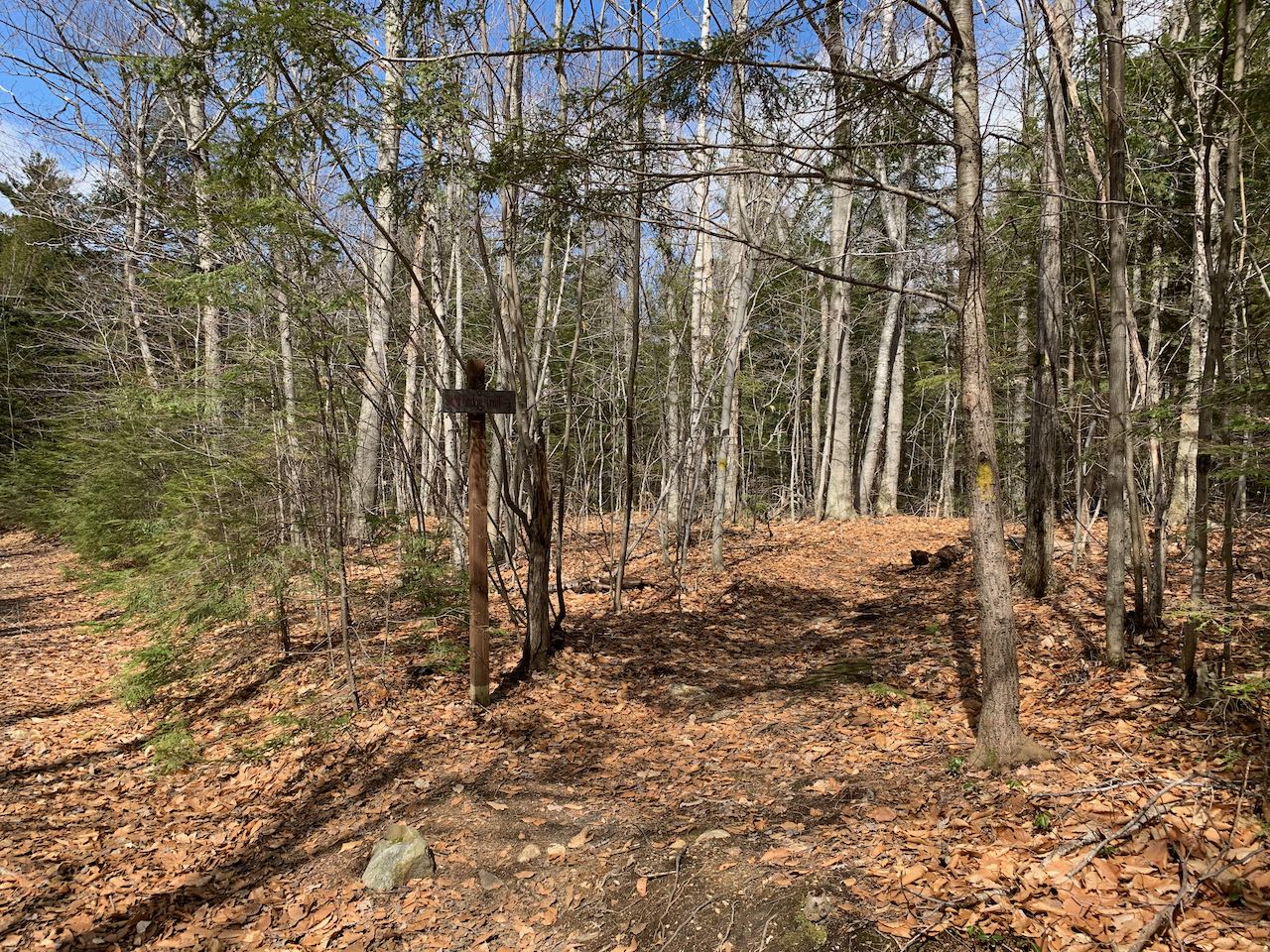
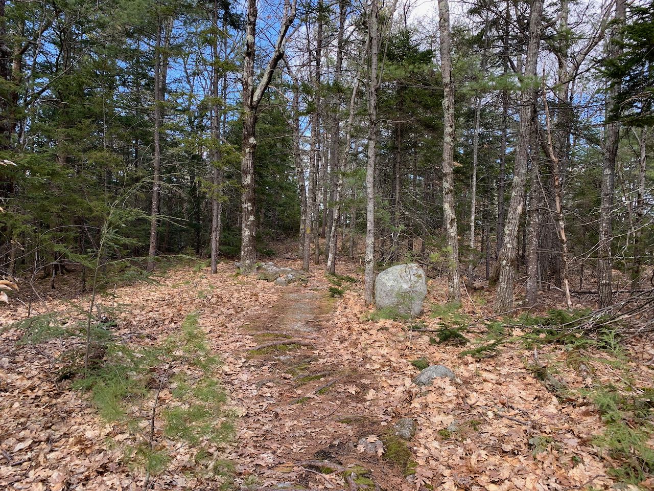
From the parking at the boat launch, walk back uphill and turn right onto the continuation of Sky Pond Road, marked with a sturdy sign for Bald Ledge Trail. Walk gradually uphill for 0.2 miles, then turn left past a gate onto a narrower road, which descends just as gradually through rows of new growth. After 0.15 miles, the path levels off, soon crossing a little stream. In another 0.2 miles, look for a signpost marking the entrance to a footpath on the right. Leave the woods road here and follow the path into the forest. It meanders across the top of the level ridge for a quarter mile, crossing the bedrock at the highest point on the ledge and dropping down to the overlook.
Stroll over the pine needle-carpeted rock down to the cleared-out edge of the viewpoint. On the left side, you enjoy a great view of the Sandwich Range, the familiar southern profile of the White Mountains. In front, you see the bog-ringed Hawkins Pond. To the right of the pond, the rolling ridge of Red Hill sprawls out. Directly beneath you in front of it all, of course, is Winona Lake. To the right of Red Hill and further behind you see the clustered summits of the Ossipee Range. Right on the opposite shore of Winona is Fogg Hill. Then, on the right side of the view, you see the marshy strip of water connecting Winona with its larger neighbor, Lake Waukewan. In the distance directly behind the lake is Copple Crown Mountain.
Printable directions page